HOME | Ashland | Bandon | Bend | Brookings | Cannon Beach | Coos Bay | Eugene | Depoe Bay | Florence | Gearhart | Gold Beach | Grants Pass | Hermiston | Jacksonville
Joseph | Klamath Falls | La Pine | Lincoln City | Manzanita | Medford | Newport | Portland | Port Orford | Rockaway | Roseburg | Salem | Seaside | Sisters | Yachats | ALL ...
HOTELS |  VACATION RENTALS |  RV PARKS |  B & B'S |  RESORTS |  WEATHER |  ROAD CAMS |  MAPS |  KAYAKING |  WINERIES |  RAFTING |  LIGHTHOUSES 
Mount St. Helens
Mount St. Helens VolcanoCam

Covered Bridges
:: Harris
:: Hayden
:: Irish Bend
:: Sandy Creek
:: Rock O' the Range
:: Cavitt Creek
:: Horse Creek
:: Milo Academy
:: Neal Lane
:: Pass Creek
:: Rochester
:: Antelope Creek
:: Lost Creek
:: McKee
:: Wimer
:: Grave Creek
:: Belknap
:: Centennial
:: Chambers
:: Coyote Creek
:: Currin
:: Deadwood
:: Dorena
:: Earnest
:: Goodpasture
:: Lake Creek
:: Lowell
:: Mosby Creek
:: Office (Westfir) Bridge
:: Parvin (Lost Creek) Bridge
:: Pengra (Fall Creek) Bridge
:: Stewart
:: Unity
:: Wendling
:: Wildcat Creek (Austa) Bridge
:: Chitwood
:: Drift Creek
:: Fisher School
:: North Fork Yachats
:: Crawfordsville
:: Gilkey
:: Hannah
:: Hoffman
:: Larwood
:: Shimanek
:: Short
:: Weddle
:: Gallon House
:: Stayton-Jordan
:: Cedar Crossing
:: Fourtner
:: Ritner

Weather Forecasts
:: Adams
:: Albany
:: Ashland
:: Astoria
:: Bandon
:: Bend
:: Brookings
:: Chiloquin
:: Dayton
:: Depoe Bay
:: Eugene
:: Florence
:: Fossil
:: Gold Beach
:: Government Camp
:: Glide
:: Hood River
:: Jacksonville
:: Joseph
:: Klamath Falls
:: Lincoln City
:: Mt. Hood
:: Newport
:: Pacific City
:: Paisley
:: Port Orford
:: Portland
:: Roseburg
:: Sunriver
:: Vida
:: Waldport
:: Yachats

Bookmark Us!

Newsletter Signup:


The Stewart Covered Bridge, Lane County, Oregon
<< Lane County Bridges << Covered Bridge Map All Covered Bridges >>


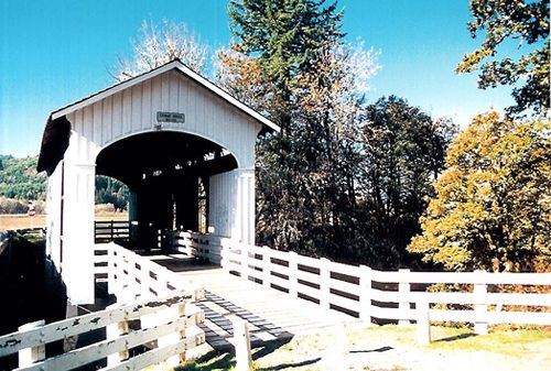
Heavy rains during the 1964 Christmas Flood brought water raging down Mosby Creek with the resulting force cracking the lower chords of the bridge.
Four years later, heavy snow falling in the Willamette Valley caused the roof bracing gave way and the entire roof caved in.
Repairs to the bridge made it usable again and it carried a 20-ton limit until it was bypassed in the mid-1980s by a concrete span.
The Stewart Bridge was officially retired in 1987, with one of the approaches removed, fumigation of timbers, and installation of a wire fence inside a portal for safety of pedestrians.
In the 1993-95 biennium, the Lane County received a grant of around $48,000 from the Oregon Covered Bridge Program to restore the bridge.


Travel one mile east of Cottage Grove on Row River Road.
Follow the sign to Mosby Creek Road, turning right and crossing the railroad tracks. Turn left (south) on Mosby Creek Road and travel approximately 3.5 miles to Garoutte Road.


Covered Bridge Information Courtesy of Covered Bridge Society of Oregon

Privacy < BACK  | HOME > Terms of Service
Contact OregonTravels.com
PO Box 1475
Medford, OR 97501
Office
541-499-4077
Email


Climb with an Accredited Guide Service


Orange Torpedo offers unique white water rafting trips on the Rogue, Salmon, Klamath and North Umpqua Rivers
Lake Creek Lodge
Seaside vacation Rentals
Flying Arrow Resort, Joseph Oregon


COVERED BRIDGES

EASTERN OREGON

MAPS & DIRECTIONS

OREGON ZIP CODES